Map
Collection object
1988.0099
H. 40.4 x W. 50.8
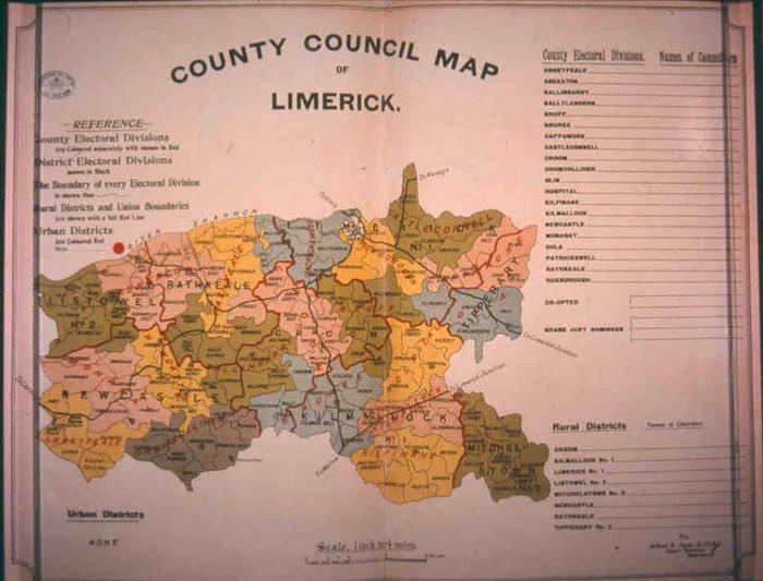
Map, photograph of, coloured. County Council Map of County Limerick. 1898. By Arthur E. Joyce, M.I.C.E.I., County surveyor, Co. Westmeath. Map shows and names County and District Electoral Divisions, and their boundaries, Rural districts and Union boundaries, towns and railways. Scale 1 inch to 4 miles. Table at right with blank spaces for the insertion of the names of Councillors of the County Electoral Divisions (listed), for two coopted members, and for two Grand Jury Nominees. Below right, table with blank spaces for names of Chairmen of Rural districts (listed). Bottom left, 'Urban Districts / None', and top left, legend, with above, stamp, oval, with within, 'BRITISH MUSEUM / 11 FEB 1899', crown on field. Double line border, with concave corners, around map. Rolled. British Library ref. no. Maps 9.dd.13, Order no. 8740907
Arthur E Joyce (mapmaker)