Map
Collection object
2006.0020
H. 101.5 W. 68.5
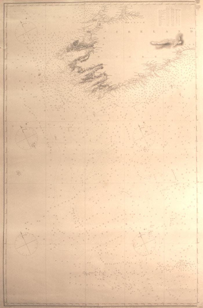
Map. Admiralty chart, The English Channel, Sheet 3; showing southwest coast of Ireland from Waterford round to Clare. 1872. At centre bottom; London Published at the Admiralty 1st July 1859 under the Supervision of Captn Washington, RN FRS, Hydrographer. Corrected to Sept 1869, Aug 72/ Sold by J.D. Potter agent for the Admiralty Charts, 31 Poultry & 11 King St., Tower Hill. Printed black on white. Covers, lat. 48-53 degrees, long., 7degrees 10 mins to 12 degrees west. Ireland lies at the top right of the chart. Soundings shown in the sea with names of banks . The Irish coast has the higher mountains represented but otherwise prominent geographical features, river mouths, points etc named. Shows soundings up the Shannon to the Fergus estuary. Lights marked with a red dot surrounded by yellow. Tide table of Irish ports at top right. 5 compasses on map. At top right; an oval inscribed Hydrographic Office, with Anchor at centre, and garland around; all over Price Three Shillings. One slight tear towards top left edge; a few pencil marks.
Admiralty (published by)