Map
Collection object
1988.0137
H. 29.50 x W. 34.20 (mounted); H. 18.7 x W. 23.6 (print); H. 21.65 x W. 28.10 (page)
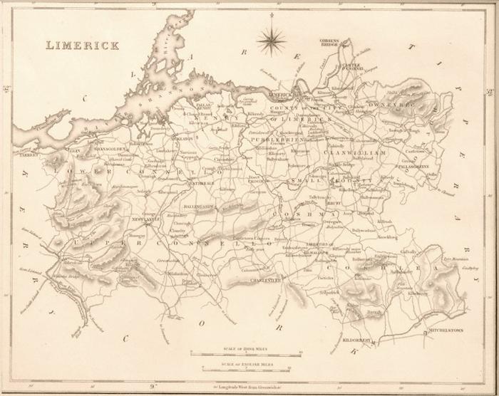
Map, b/w. County of Limerick. By Samuel Lewis the Elder. Scale c.5 Irish miles to 1 inch. From book, Lewis, A Topographical Dictionary of Ireland, 1837. Shows the roads, canal, rivers, towns and villages, uplands, and baronies of Co. Limerick. Shows portion of Shannon estuary and of Shannon river. Also portions of other counties adjoining. Drawm by R. Creighton, Engraved by I(J). Dower, Pentonville, London. Framed by strip, alternately black and plain, marked with latitude and longitude. Mounted.
R Creighton (artist)