Map
Collection object
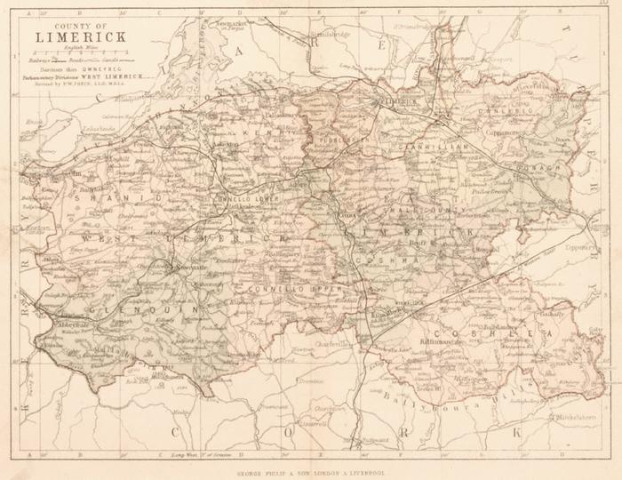
1988.0136
H. 25.20 x W. 30.60 (mounted); H. 16.9 x W. 22.3 (print); H. 18.10 x W. 22.90 (page)
Map, coloured. County of Limerick by P.W. Joyce, c.1880. Scale; 6.5 miles to 1 inch. Shows the roads, railways, canal, rivers, towns and villages, estates and big houses, uplands, baronies (coloured) and Parliamentary Divisions of Co. Limerick. Shows portion of Shannon estuary and of Shannon river, in blue. Portions of other counties adjoining in b/w. George Philip & Son, London & Liverpool. Top right: 18. On R/ LIMERICK. Mounted.
George & Son Philip (published by)