Map
Collection object
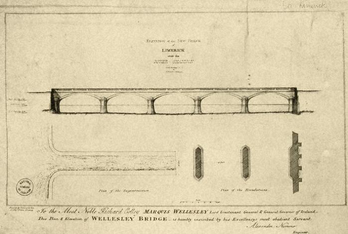
1987.0161
Size, frame edge to edge, on photo, L. 36.0 x W. 20.7
Map, photograph of, unframed. Plan and Elevation of Thomond Bridge, 1823? Title, top centre, Elevation of the New Bridge / of / Limerick / over the / River Shannon / Alexr. Nimmo, C.E. / & / F.R.S.E. M.R.I.A. Centre, elevation bridge, with left, tide levels marked. Below, left, the Plan of the Superstructure., right, the Plan of the Foundations., Scale of miles, both with distances in feet shown. Bottom, centre, Scale, with below, line scale in feet. Bottom, centre, below border and line frame, To the Most Noble Richard Colley Marquis Wellesley Lord Lieutenant General & General Governor of Ireland - / This Plan & Elevation of Wellesley Bridge - is humbly inscribed by his Excellencys most obedient Servant / Alexander Nimmo / Engineer. Bottom left, just below frame, Printed by Neele and Son. / Lithoc. Press Strand. No NLI neg. no., De Nais no. 500. Top, above frame, handwritten, Co Limerick.
Alexander Nimmo (surveyor)