Map
Collection object
1987.0157
L. 61.0 x W. 46.5
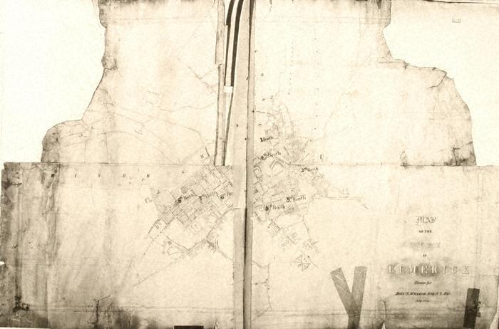
Map, photograph of, unframed. Map / of the / City / of / Limerick / Drawn for / John S. MacLeod Esq. S.I. Etc. / July 1856 (title, etc, bottom right). Plan of the city centre showing street plan, street names, and prominent buildings, with superimposed over (not written level), a series of booths with an accompanying mark of a dot in a ringed circle, ie 1 Booth (at Courthouse), 2nd Booth (Clare Street), 3rd Booth (St John's Square), 4th Booth (Rutland St), 5th Booth (Upper William St), 6th Booth (vicinity of Roches Street?), 7th Booth (SW corner of junction of Glentworth Street and George Street), 8th Booth (vicinity of Henry Street?). Compare plan of New Barracks to that shown in LM 1987.155. Decorative border around map. Bottom right, at border, C. Reilly Del. Top right, no. 11 (on backing material). Booths = Polling Booths? National Library negative no. 20211. De Nais no. 508.
C Reilly (mapmaker)