Map
Collection object
1987.0153
Photo sheet size L. 61.0 x W. 46.9
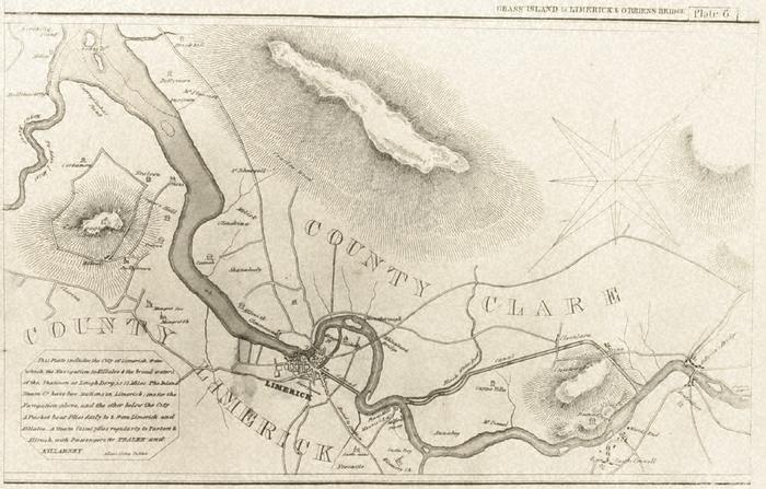
Map, photograph of, unframed. Map of the Shannon navigation from Parteen Rapid to Kinchilly Point, including canals (note locks? on canal). Also general topography of surrounding countryside, and roads, big houses, castles and churches. Plate 6 from book of Shannon Navigation, 1829. Inset, bottom left, in line frame, This Plate includes the City of Limerick, from / which the Navigation to Killaloe & the broad waters, / of the, Shannon at Lough derg, is 15 miles. The Inland / Steam Co. have two stations in Limerick; one for the / Navigation above, and the other below the City. / A Packet boat Plies daily to & from Limerick and / Killaloe _ A Steam Vessel plies regularly to Tarbert & Kilrush, and passengers for TRALEE & / KILLARNEY (space) Allens Lithog Dublin. Pair of superimposed stars with spearpoint for North point, at upper right. National Library negative no. 20228.
Allens Lithog (engraver)