Map
Collection object
2002.0470
H. 15.8 W. 33.8
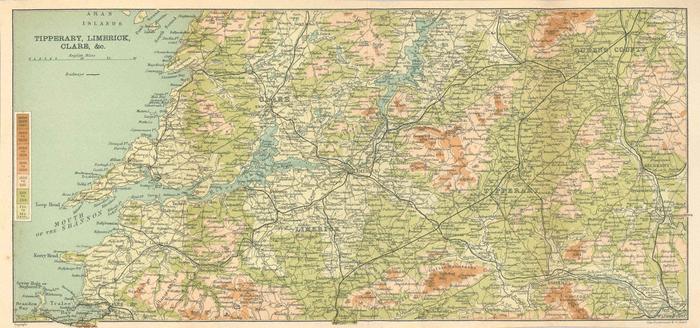
Map of Cos Limerick, Calre and Tipperary by John Bartholomew & Co, Edinburgh, from C. S. Ward, Thorough Guide: Ireland, 1911. Extreme l., Brandon Bay; extreme r., Waterford city; extreme N., Portumna; extreme S., Buttevant. Titled Tipperary, Limerick, / Clare &c. in top l. corner, scale of 10 miles to 1 inch. Coloured, graduating from pale green at sea level to 250 feet to dark brown above 2500 feet. Double border around, Buttevant and Castlegregory breaking border below, Copyright below border extreme l., John Bartholomew & Co., Edin. extreme r. Folded to fit in book.
John & Co Bartholomew (printer)