Map
Collection object
0000.1904
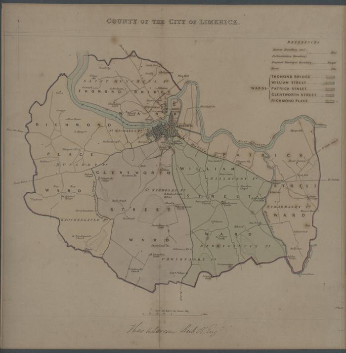
Map. County of the City of Limerick by Thomas A Larcom, Lt Royal Engineers, showing ancient and parliamentary boundary, proposed municipal boundary, wards(coloured). Scale 1in-1m. Js Basire Sc with additions by G Menzies. Printed by H Martin. From Parliamentary Representation in Ireland: Reports of the Commissioners and plans, 1832, pl no 11. Framed
Lt Thomas A Larcom (surveyor)