Map
Collection object
1996.1182
H. 47.0 W. 29.4
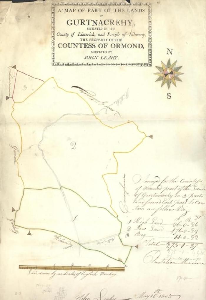
Map, manuscript estate, 1805. Printed in rectangle at top: A Map of Part of the Lands / of / Gurtnacrehy (Gortnacreha), / Situated in the / County of Limerick, and Parish of Kilneedy (Kilmeedy), / The Property of the / Countess of Ormond, / Surveyed by / John Leahy. Land outlined in red, yellow and green, numbered 1 to 3, handwritten key, High Sand, Low Sand, Bog, with acreages. Lands around named in black ink: Clouncuravan, Garrane, Garbally, Kilmeedy, Carroughmore, Lower Gurtnacrehy. Coloured star compass top r., scale below labelled: Laid down by a Scale of English Perches. Signed by Leahy and dated May 16th 1805. Amendments in pencil: Road from Rathkeale through land; larger acreage below Leahy total, new total labelled by Mr T Scanlon's map. Mathematical calculations of area and money below. Heavy white paper, folded twice. Watermark: Hayes & Wise / 1800; vertical white lines, closely spaced darker and lighter horizontal lines. Vertical tear through title. Damp stain and weakening of structure top l. across top.
John Leahy (surveyor)