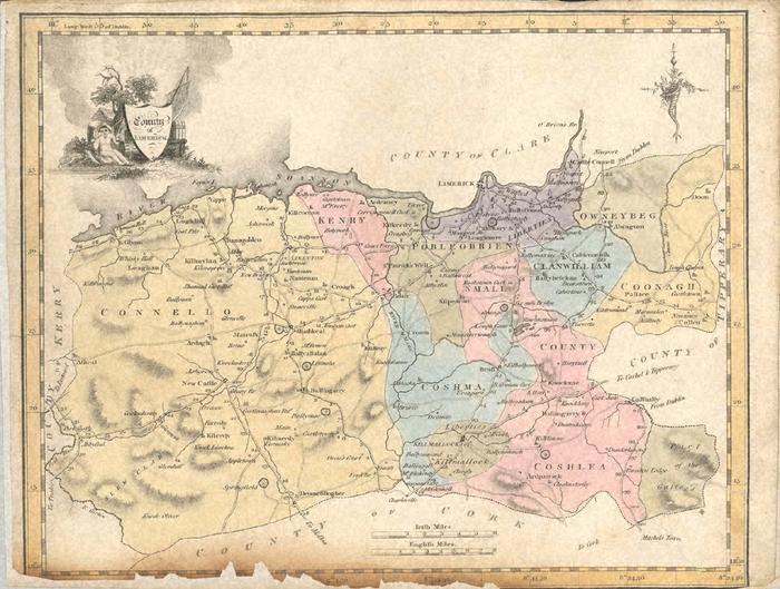
Map
Collection object
1991.0124
27.6 by 20.7
Map. Co. Limerick. Shows the county with the baronies, main roads and town; Cork, Kerry, Tipperary and Clare named but no detail. Titled at top right "County of Limerick"; title is within a shield leaning up against barrels below a tree with a naked child to one side and a sail behind. All set within a border marked with latitudes and longitudes, border also painted. Colours used on map yellow, pink, blue, purple and a dirty grey brown. Scale given in both English and Irish Miles; former 1.5 inches to 8 miles; latter c1.5 inches to 6 miles. The lower edge is very foxed and cracked and the whole page has been mounted onto a separate sheet, itself of some antiquity.