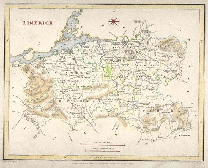
Map
Collection object
1990.0085
H. 24 W. 30 Mount H. 32 W. 36, ope H. 21.2 W. 26.1
Map. Limerick taken from Lewis' Topographical Dictionary, 1837. Shows the county with barony boundaries, roads and hills marked, with parts of Clare, Tipperary Cork and Kerry around. Hand-coloured in blue, brown, green red-brown and yellow. Frame around the map; title "Limerick" at top left, cardinal points at centre top, and scales at bottom. Scales 2.125 inches to 10 Irish Miles and 1.625 inches to 10 English miles. Within the frame are latitude and longitude markers for every 10 mins. Below frame; left "Drawn by R. Creighton; centre "Drawn and engraved for Lewis' Topographical Dictionary"; right "Engraved by L. Dower, Pentonville, London". Reverse blank. Attached to mount at top and bottom with sellotape; top edge ragged from having been torn from a book. Olive green mount.
R Creighton (drawing)