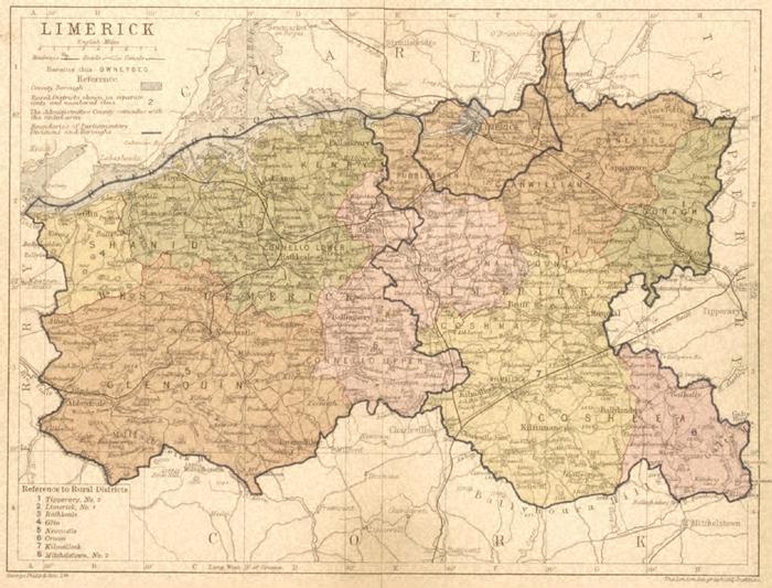
Map
Collection object
1990.0083
Map H.18.1 W. of the two leaves taped together 23.3 Mount H. 28 W. 32, ope H.17.1 W.22.1
Map, printed, mounted; "Limerick. Map of the city and county showing the 8 rural districts into which the county was divided. Printed in black on white, with each district coloured. The map also shows the parliamentary divisions of the county as a blue line and the railway lines. Printed with barony names, the rural divisions do not respect them. Parts of Clare, Tipperary and Cork are shown as well, but uncoloured. Colours orange pink, yellow and green, with blue for the Shannon. Black frame around with a latitude and longitude grid lines every 10 minutes, and the grid also lettered A-H and 1-4. Title, scale and part of key at top left; scale 1.25inches = 8 miles; key to rural districts at bottom left. Below frame left "George Philip & Son, Ltd."; at right "The London Geographical Institute". The map is in two halves taped together on the reverse. Reverse is also printed with maps; southern Leitrim (with parts of Roscommon and Longford) on the reverse of west Limerick and north Derry (with parts of Donegal and Antrim) on the reverse of east Limerick. Both of these also show rural districts, and on the Leitrim one there is a page number "20" at the top of the page. The map is attached to the mount with sellotape along the top. Dark wine red mount with gold painted line around the map.
George & Son Philip (published by)